

Geographic information
The important information for hazard mapping are those on topography, ground condition, as well as the locations of shelters and other facilities related with disaster prevention. The maps including them are as follows:
Active Fault Map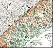
Active Fault Map The purpose of this map series is mainly to serve as base information for developing earthquake disaster prevention measures for urbanized areas in Japan. At a scale of 1:25,000, it gives detailed positional data of inland active faults and active flexures together with topographical classification. After the Southern Hyogo Prefecture Earthquake(Great Hanshin Awaji Earthquake) of 1995, needs grew for information on active faults and for its release. Responding to them GSI has collaborated with researchers of active faults to prepare the map series. Land Condition Map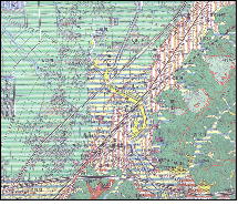
Land Condition Map part of the This is a map to provide basic data for countermeasures against damages of winds, floods and debris flows for the large plain areas and their neighborhoods in Japan. The scale is 1:25,000. The map gives information on topographical classification, ground elevation line(at a 1-meter interval), and facilities related with disaster prevention. An analysis of damages caused by the Isewan Typhoon in 1959 established a correlation between topographical classification and damages by floods and high tides. This finding eventually led to the efforts of development of this map. Land Condition Map of Coastal Areas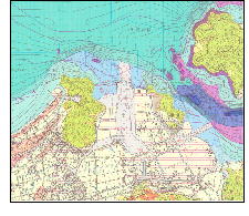
Land Condition Map of Coastal The map, at a scale of 1:25,000, covers coastal areas of less than 50m in depth all around Japan. It is designed to provide basic data for disaster prevention measures, specifically of tsunamis and high tides. An integrated approach is adopted for surveys of land and water areas. Data available in this map are bathymetric contours(at a 1-meter interval), topographical classification, and layer depth down to the alluvium base. Land Condition Map of Volcano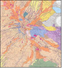
Land Condition Map of Volcano The map is designed to provide basic information necessary for formulating countermeasures against volcanic disasters at scales of 1:15,000-1:50,000 for major active volcanoes of the country. The data given in these maps are features formed by lava produced by volcanic activities, pyroclastic flows, mudflows as well as facilities for volcanic activity observation and for disaster prevention. 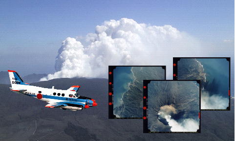
Survey aircraft "Kunikaze 2)" of GSI Aerial photographs are photographs taken from an airplane during its flight by an aerial camera. The image data they provide of land surface are widely used for various administrative purposes and others, notably for national land utilization, security and disaster prevention planning. They have proved to be effective in disaster prevention efforts of the national and local governments and other related organizations. A comparison of aerial photos of the same site before and immediately after a disaster will be helpful in assessing the extent of damages and disaster prevention planning. 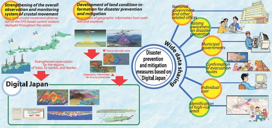
It is a concept of virtually representing the national land on computers based on geographic information integrated through positional data. This new system is expected to play an increasingly important role for the national land management. Appropriate development and compilation of various geographic information is essential for the efforts of mitigating potential damages by disasters. Then the information needs to be shared among the parties concerned from the national government to municipalities. "Digital Japan" allows an easy access to the geographic information on the internet, thus extensive data sharing among all those concerned. It facilitates prompt and strategic implementation of disaster prevention measures and contributes to promotion of national security and safety. | |||