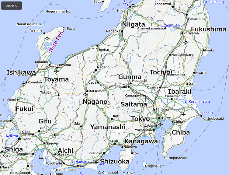
Experimental release of Japan map in English notation
|
GSI has been working on making the easy-to-understand maps for overseas visitors by settling “Notation Rules of Geographical Names, etc. in English” and new map symbols for overseas visitors (hereinafter referred to as “the rules”), to be prepared for Tokyo 2020 Olympic and Paralympic Games, and also to support providing overseas visitors with trouble-free trip and safe and comfort stay in Japan.
GSI has released an online English map adopting above mentioned rules on an experimental basis in order to expand use of the rules and to find issues for improvement of the maps for overseas visitors. This map, employing vector tile format, can provide foreign visitors with easy-to-understand information by displaying geographical name and types of symbols in English, and also by reading geographical name with its correct pronunciation in Japanese through a web browser. In addition, users can obtain the map with necessary information by adding/deleting the map information, e.g., name of the facility. Users are required to comply with the “GSI Website Terms of Use”to use these vector tiles that adopt the rules. GSI hopes that the purpose of this experimental release is well understood and that many people use the map.
Rules of notationGSI translates Japanese geographical name based on “Notation Rules of Geographic Names, etc. in English” (in Japanese). Please note that we mainly translate geographical names of natural features, residential geographical names, and traffic facilities names, but do not translate all Japanese.
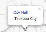
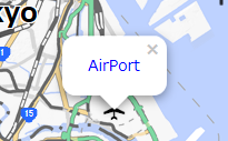
Functions of the online map1. Displayed Map Symbols: Example: |