

Maps shows lessons from historical disasters experienced by our ancestors.
GSI will newly develop the map symbol for "natural disaster monuments" to disseminate the lessons from past disasters.2019-03-15: GSI will start to collect information on “natural disaster monuments*” in 2019 in cooperation with local governments.
The new information will be released on the web map “GSI Maps” and 1:25000 topographic maps developed by GSI. Through these efforts, GSI will help enhance public preparedness for natural disasters. * Natural disaster monuments Monuments erected in memory of past natural disasters to pass down information about disasters, such as tsunami, flood, volcanic and landslide disasters, to the next generations Press Release in Japanese 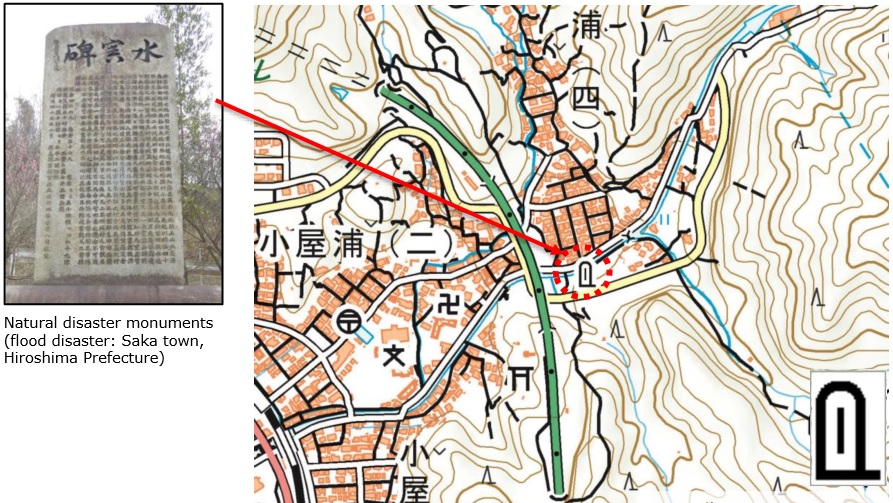
Image shown on 1:25000 topographic map |