

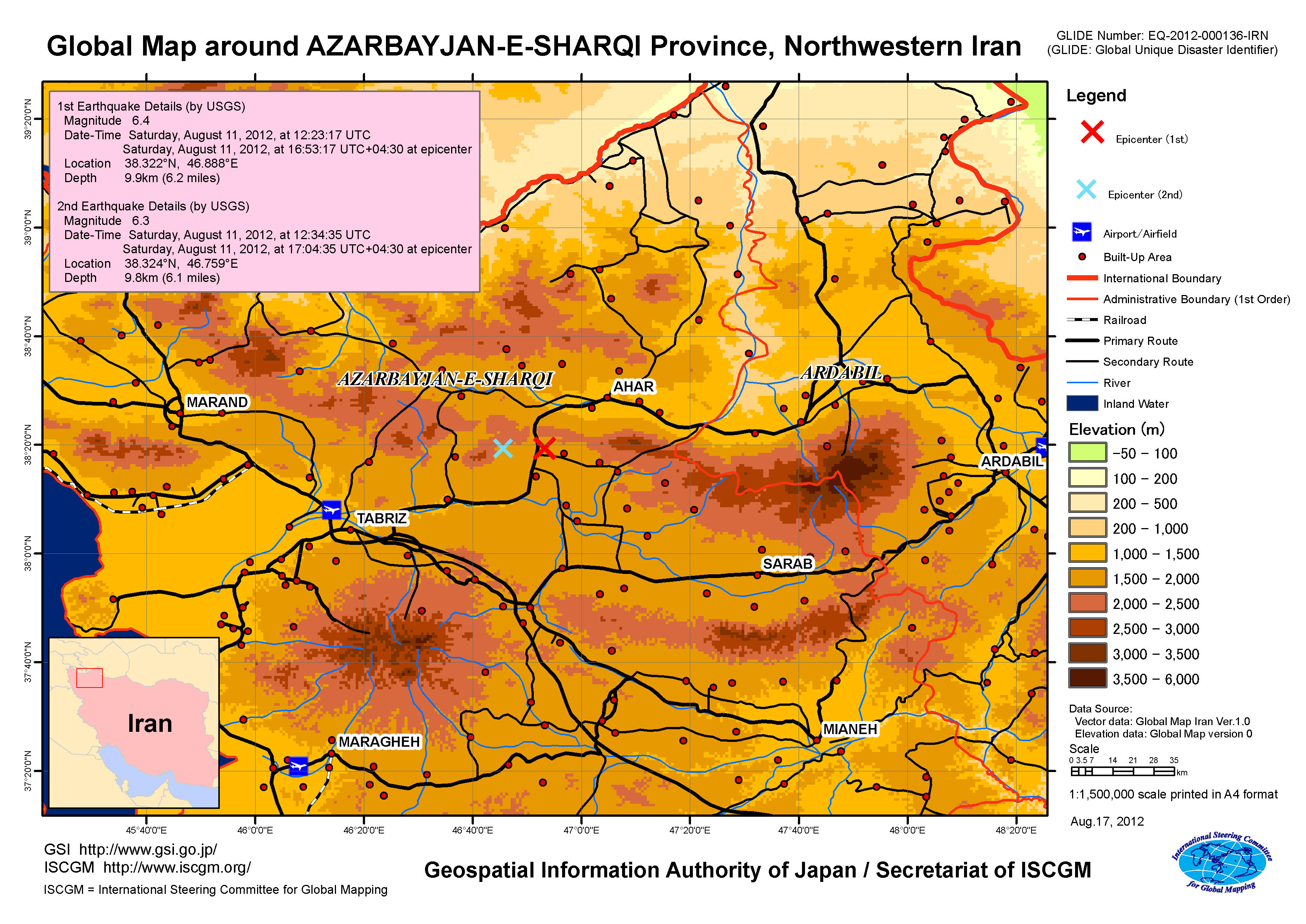
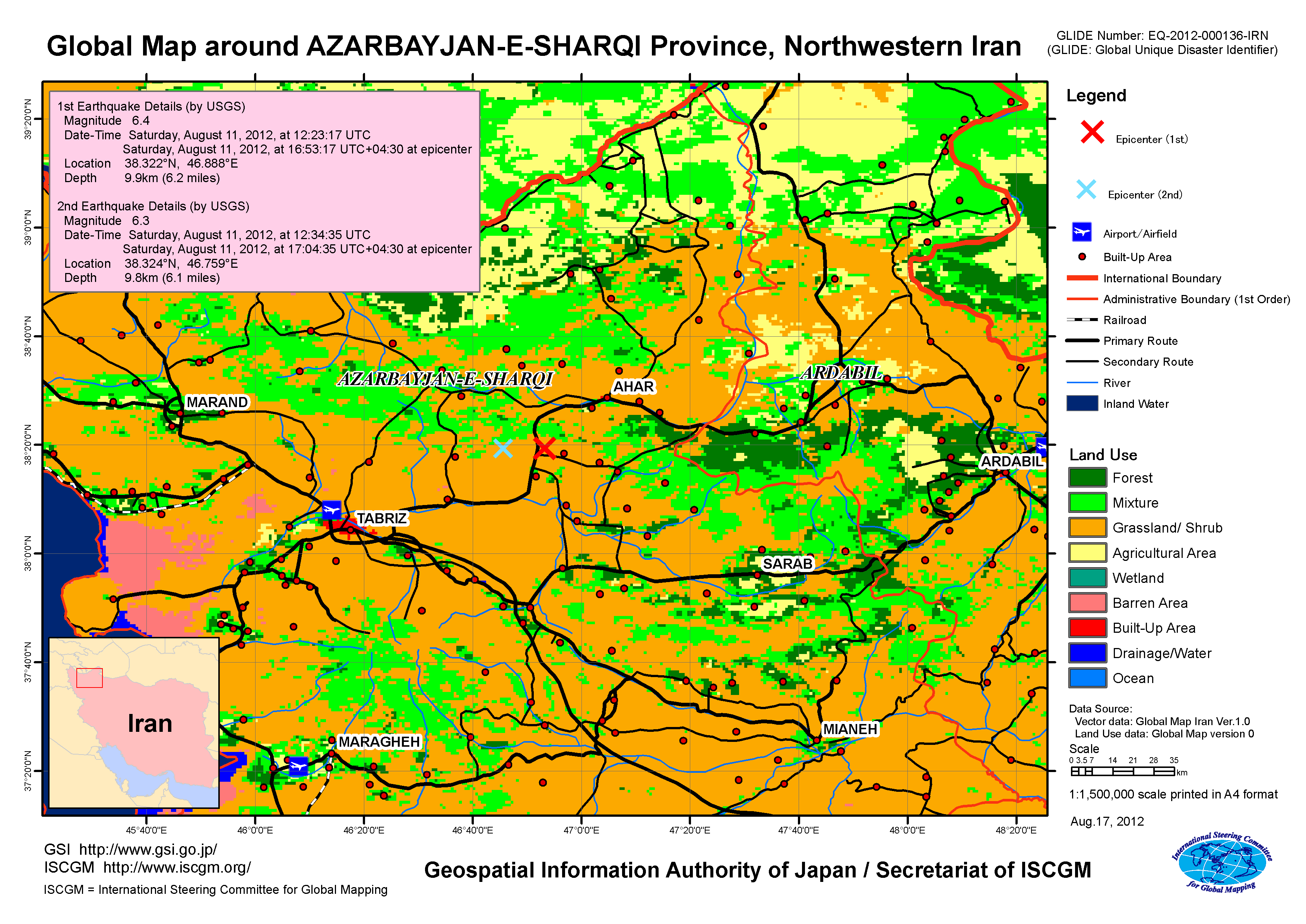
Earthquakes in northwestern Iran, Aug. 2012
Release of maps of northwestern Iran by using Global Map1.Release of the mapsIn relation to the earthquakes on August 11th which consecutively hit northwestern Iran, firstly at 4:53 p.m. (9:23 p.m. Japan time) of Magnitude 6.4 and secondly at 5:04 p.m. (9:34 p.m. Japan time) of Magnitude 6.3, Global Map around AZARBAYJAN-E-SHARQI Province of northwestern Iran, the heavily damaged area, is released. The maps provide information on landform and land use at and around the epicenters (main quakes). 2.Use of this mapThe map is freely available for non-commercial purposes.
3.Global Mapping ProjectGlobal Mapping project is an endeavor advocated by the Ministry of Construction (present Ministry of Land, Infrastructure and Transport) in 1992 to develop a digital map (Global Map) covering the whole globe to accurately express the status of global environment, implemented in international cooperation of respective National Mapping Organizations (NMOs) of the world. The Global Map can be used for studying global environmental problems, etc.
The Global Map data development is underway steered by the International Steering Committee for Global Mapping (ISCGM). The Geospatial Information Authority of Japan (GSI) serves as the ISCGM Secretariat which takes a central role of the project management. The GSI also provides developing countries with necessary technologies. The details of the project are shown at the following website.
|