The 2011 off the Pacific coast of Tohoku Earthquake: Crustal Deformation and Fault Model
Crustal Deformation and Fault Model obtained from GEONET data analysisReleased: Apr. 22, 2011, Japanese version of this page
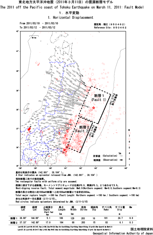
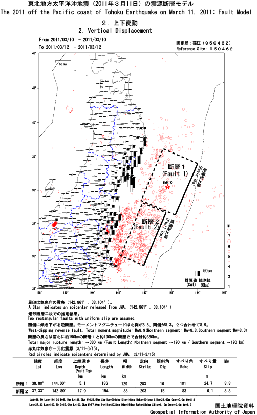
Crustal Deformation and Fault ModelA mega thrust earthquake with a moment magnitude 9.0 (JMA) occurred in Japan on March 11, 2011 (JST). We constructed a fault model using coseismic surface displacement data observed by the GPS Earth Observation Network System (GEONET).
A fault model which consists of two rectangular faults with a uniform slip in an elastic half-space shows that
GSI manually collected GPS data which were unavailable due to the suspension of a data transmission system just after the earthquake. We used these data to revise the preliminary model presented on March 13, 2011. Fault ModelThe 2011 off the Pacific coast of Tohoku Earthquake
ContactIMAKIIRE Tetsuro : Principal Researcher for Geography and Crustal Dynamics Research Center
TOBITA Mikio : Director of Division (Crustal Deformation Research Division) OZAWA Shinzaburo : Chief Researcher (Crustal Deformation Research Division) NISHIMURA Takuya : Chief Researcher (Crustal Deformation Research Division) SUITO Hisashi : Cheif Researcher (Crustal Deformation Research Division) KOBAYASHI Tomokazu : Researcher (Crustal Deformation Research Division)   Some files are available in PDF format. To view PDF files, Adobe System's free "Adobe Reader" software must be installed. Please visit the following link to download the free software. |