Differences between Volcanic Base Map and Land Condition Map of Volcano
Differences between Volcanic Base Map and Land Condition Map of Volcano
| |
Volcanic Base Map |
Land Condition Map of Volcano |
| Map characteristics |
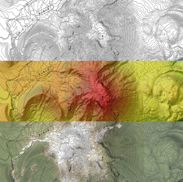
Large-scale topographic map that accurately depict landforms |
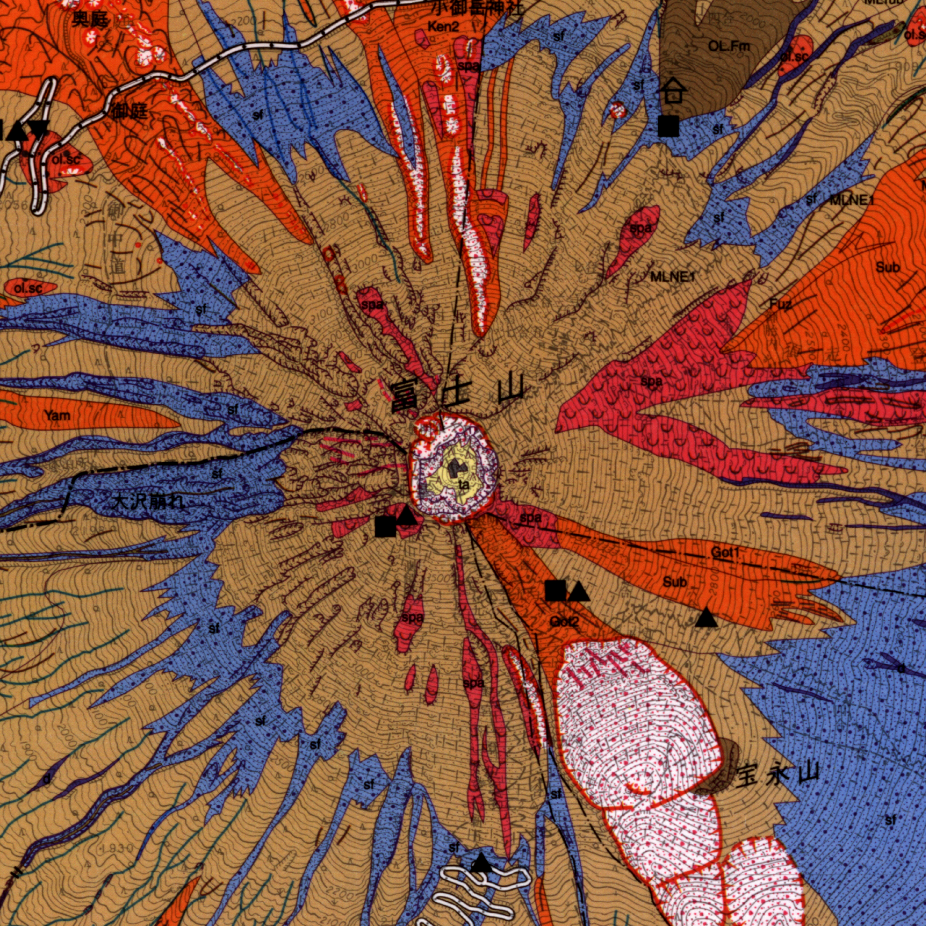
Medium-scale thematic map that topographically depict classifications of land conditions, etc. |
| Map projection |
Transverse Mercator projection
(plane rectangular coordinates) |
Universal Transverse Mercator projection |
| Methodology |
Accurate mapping by photogrammetry,and Airbone laser scanning |
Manual compilation after aerial photograph interpretation, in situ surveys, and analysis on various materials. |
| Accuracy |
Planimetric position, within 0.7 mm on the map.
Height (standard elevation point),
within 1.6 m.
Height (contour),within 2.5 m. |
Planimetric position, within 0.7 mm on the map.
Height (standard elevation point),
within 3.3 m.
Height (contour),within 5.0 m. |
| Contents |
Topography (shown by contour lines)
Locations and form of volcanic landforms |
Classifications of volcanic landforms,
Age and way of formation of volcanoes,
Locations of disaster prevention facilities and organizations. |
| Sample Image |
|
 |
| Products |
- Publication Map
- Raster Image
- Vector Data of Contour
- Digital Elevation Model
|
- Publication Map
- Raster Image
- Vector Data of Classifications of volcanic landforms
|
|

