GSI HOME > Antarctic Geospatial Data > Products Categories > Digital Elevation Topographic Data (SHAPE format) : Outline  

Digital Elevation Topographic Data (SHAPE format) : Outline

  • Data Outline

Outline

Digital Elevation Topographic Data (SHAPE format)

This Digital Elevation Model(DEM) data was created from images of ALOS(Advanced Land Observation Satellite) observed from 2006 to 2011 and covered from 21 to 45 degrees East longitude in north of 73 degrees South latitude with a focus on coastline and mountain area.

Data Format and Specification

This DEM data format is the Shapefile format.
The resolutions of this DEM data are 0.4 second (North-South), 1 second (East-West), and 0.1m (Vertical).
The creating process is based on automatic correlation and plotting of ALOS/PRISM and analysis of ALOS/PALSAR.

Area of Data

  1. Prince Olav Coast and Souya Coast Area
    DEM of Antarctica in 2010 (Technical material No. C1-406)
  2. Prince Harald Coast Area
    DEM of Antarctica in 2011 (Technical material No. C1-412)
  3. Sor Rondane Mountains Area
    DEM of Antarctica in 2012 (Technical material No. C1-419)
  4. Prinsesse Ragnhild Coast Area
    DEM of Antarctica in 2013 (Technical material No. C1-433)

*Please note that uncovered area may occur partially, due to the conditions of satellite image or ground.

Digital Elevation Model

Click on the area of the map you would like to view sample images.
Only altitude tinting sample images for each area can be seen, due to huge data size.

Digital Elevation Model Map Prince Olav Coast and Souya Coast Area Prince Harald Coast Area Prince Harald Coast Area Sor Rondane Mountains Area Sor Rondane Mountains Area Prinsesse Ragnhild Coast Area

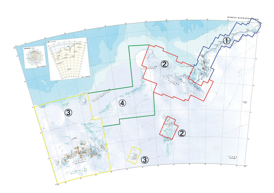
Please submit the usage application of technical materials, in order to use this DEM data.