


Continuous GNSS (GPS) Observation : Outline
OutlineContinuous GNSS (GPS) Observation Continuous GNSS (GPS) observation station, a.k.a. IGS station at Syowa station (SYOG), was established on the 36th JARE (1995), and is still in use today. It is the origin for surveys taken around Syowa station. Also, we join in International GNSS Service (IGS), and every day, data is sent automatically via Intelsat to Japan, which is then sent to IGS Data Center.
SYOG was the 7th station to be registered with IGS, and is recognized as an indispensable station in Antarctic research. 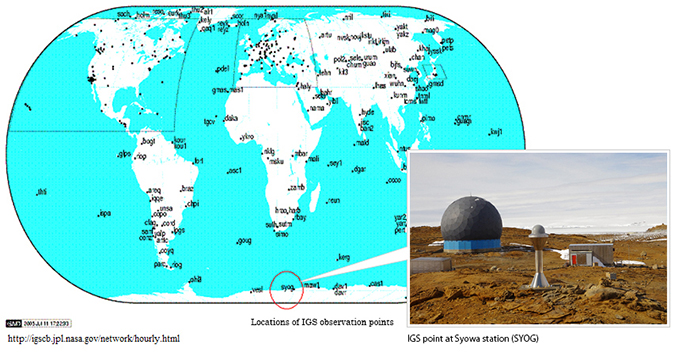
Continuous GNSS(GPS) Observation Crustal movement in Antarctica as seen by IGS DataWe are starting to get an accurate view of Antarctic crustal movement through GNSS continuous observation.
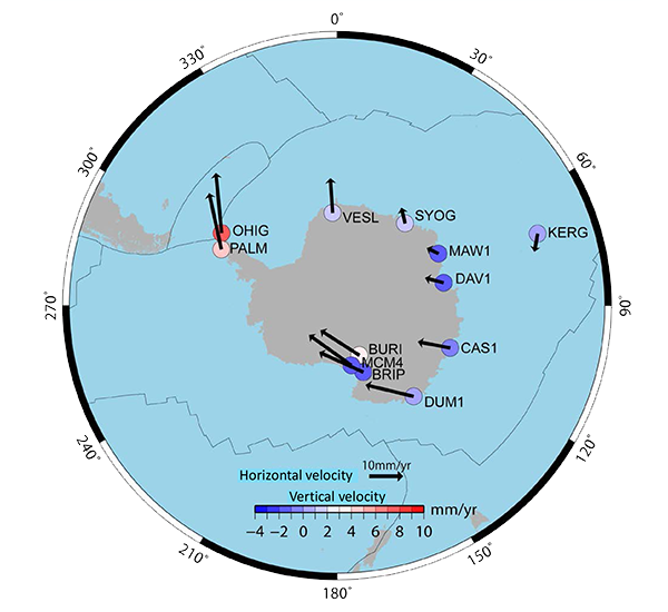
Movements of Antarctica by analysiis of IGS data (1996-2009) It seems that each observation point moves centering on off thecoast SYOG in clockwise direction. This is because that Antarctic plate containing Antarctica moves in clockwise direction, not because Antarctica itself deforms.
Site velocities were estimated by fitting the coordinate time series to linear line. |