


Leveling : Outline
OutlineLeveling Leveling is used to determine the correct elevation of control points which is crucial to topographic mapping. Also, repeated surveys can be taken to detect crustal activity induced by post-glacial rebound (uplift phenomenon caused by deglaciation).
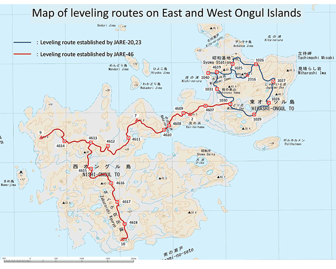
The current elevation was measured on a point facing a western cove of East Ongul Island, and is based on the average sea level by the tidal observation data measured between January 1981 and January 1982. Leveling Route Chart A leveling route was formed between the bench marks established on East and West Ongul Islands on the 46th JARE.
Fluctuation Graph We have taken four leveling measurements on East Ongul Island, but only once on West Ongul Island on the 47th JARE (2005), and therefore have no data on its fluctuation.
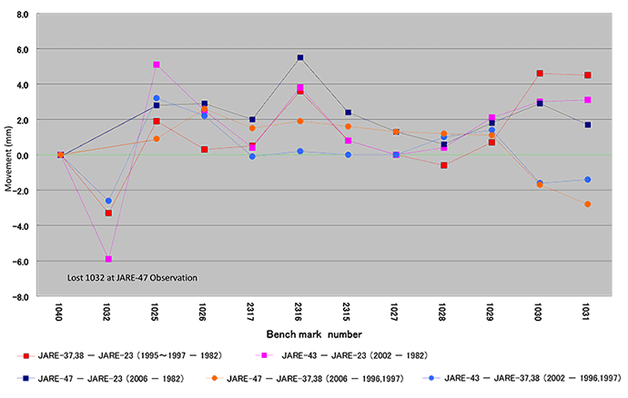
Movement observed by leveling in East Ongul Island |