Participation in international geodetic observations
GSI participates in multilateral joint campaigns and observations.What is IVS?IVS is an international collaborative initiative which was established by International Association of Geodesy (IAG) in 1999 with the purpose of promoting international observation campaigns and technical development on VLBI. Under the cooperation between member organizations, IVS is operating and maintaining global VLBI observation network, analyzing the observation data and providing various information on motion of the earth such as precise coordinates of the stations and the earth orientation parameters.
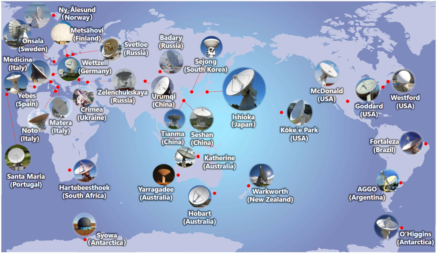
International VLBI Observation Network GSI’s contributionGSI has been participating IVS from the beginning of the service as a part of VLBI observation network, one of correlators and one of analysis centers, and contributing to development of global geodetic reference frame and monitoring the earth rotation. In order to enhance regional cooperation in Asia and Oceania, IVS established a subgroup of IVS, Asia-Oceania VLBI Group for Geodesy and Astrometry (AOV) in 2014. GSI played a leading role on the establishment of AOV and is actively involved in AOV by carrying out regional observations and by serving as the Secretary.
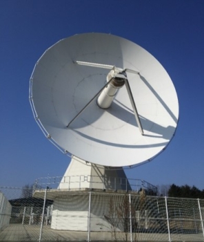
VLBI stations of GSIGSI is operating a VLBI station in Ishioka, Japan
VLBI antenna Links to the related pages What is IGS?IGS is an international collaborative initiative which was established by IAG in 1994 with the purpose of sharing GNSS observation data and providing GNSS related products such as satellite orbit information. Under the cooperation between member organizations, IGS is operating and maintaining global GNSS observation network, sharing and analyzing GNSS data and providing various GNSS related information such as precise satellite orbit information which is essential for precise GNSS positioning. In order to support its activity, GSI has been participating in IGS from the establishment in 1994.
GSI’s contribution
Operation of the IGS Analysis CenterGSI, in collaboration with the Japan Aerospace Exploration Agency (JAXA), has been participating in the IGS Analysis Centers (ACs) since December 2023. ACs are IGS-accredited organizations in charge of calculating precise ephemeris for GNSS satellites. The IGS products, widely used as international standards, are calculated by the IGS integrating a total of 13 AC products. As one of the ACs, GSI and JAXA contribute to the generation of IGS products.
Our products are available at the following URL with registration: https://jgxnet.gsi.go.jp/en/top/ 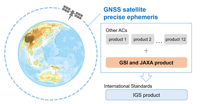
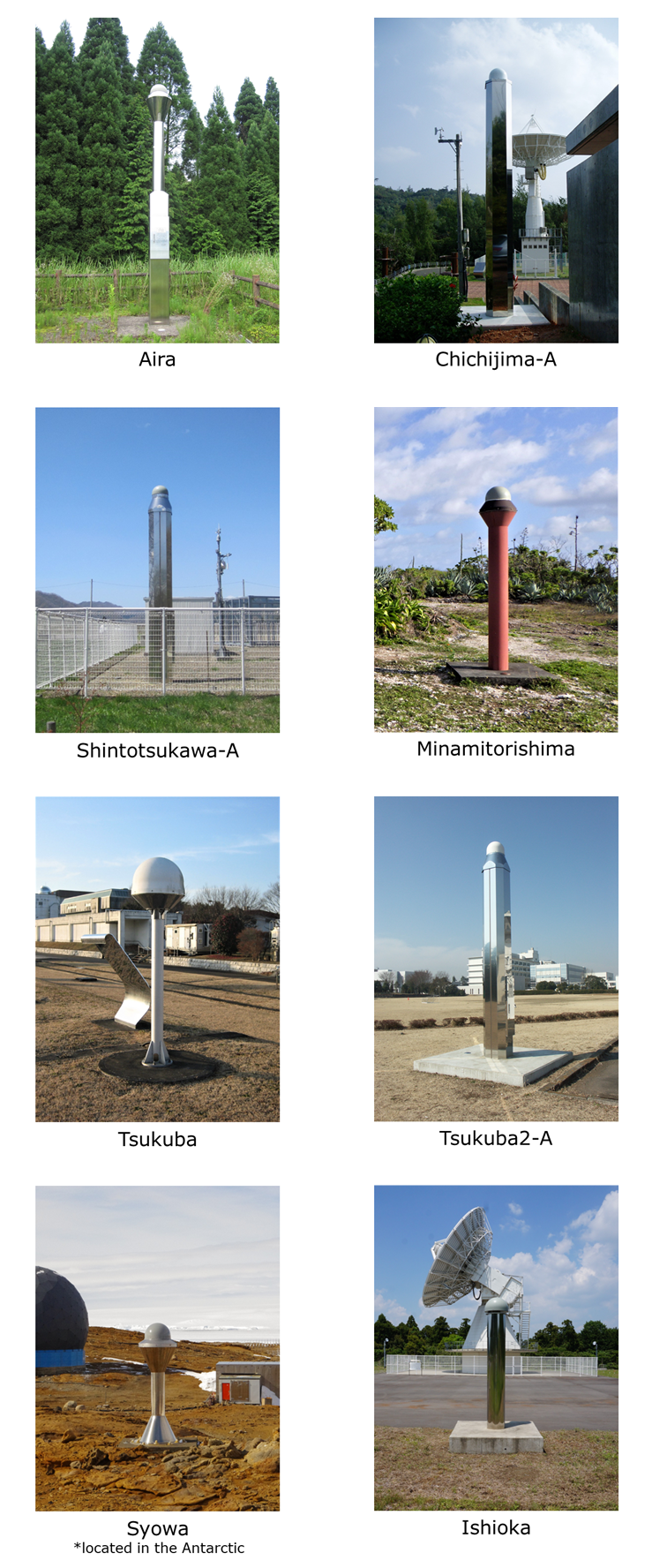
IGS stations of GSIGSI is currently operating 8 IGS stations.
Links to the related pages
|